| Home | Site Visits | Database | Links | Contact |
| Salford Docks Branch, SJ816979 | |
| Back to 3rd October 2009, Oldham | |
| Click on individual pictures to view a larger version in your browser or Download all 6 items (filesize = 5.06MB) | |
|
|
|
|
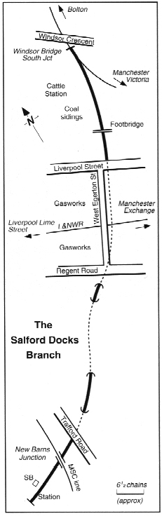
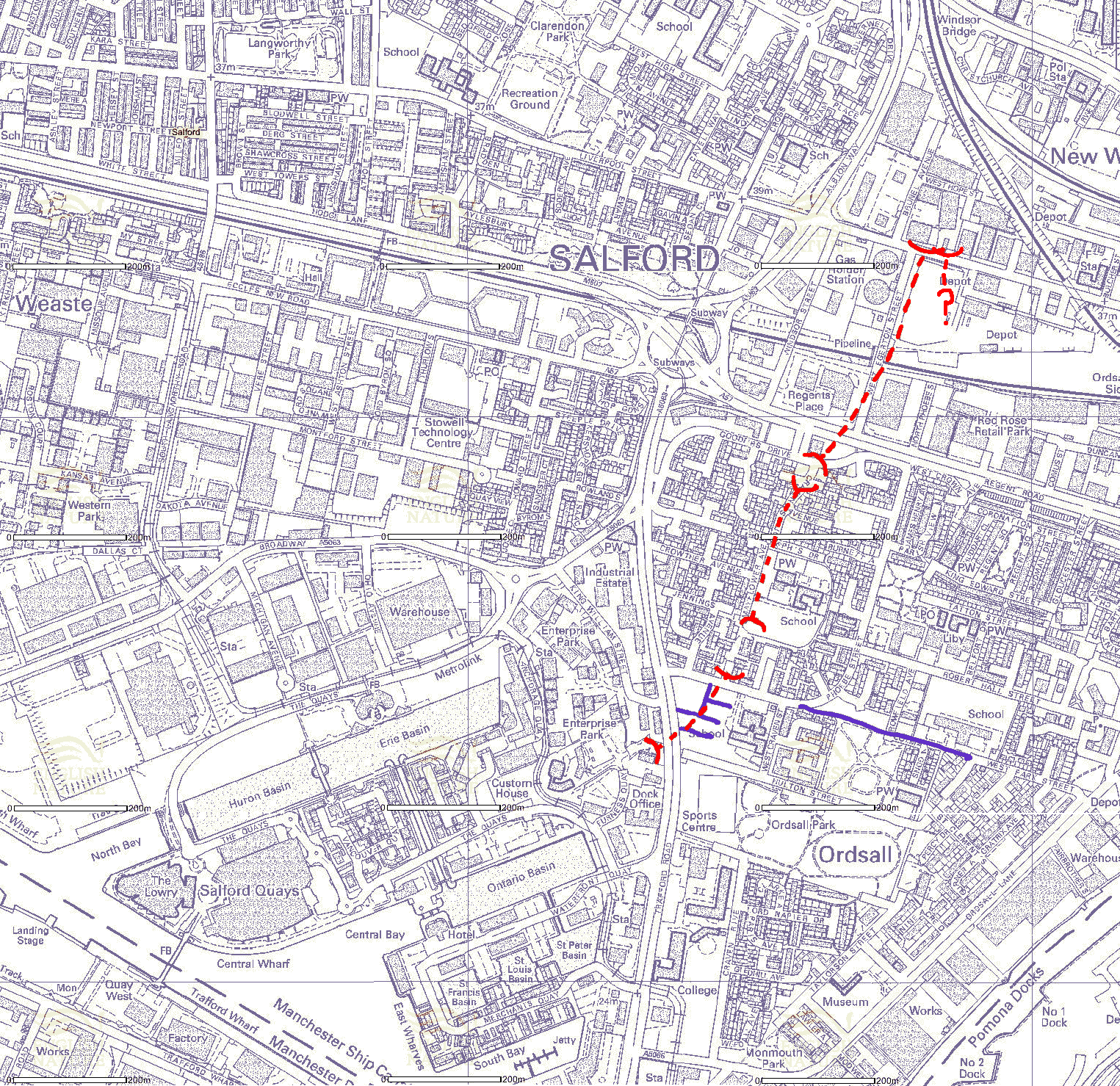
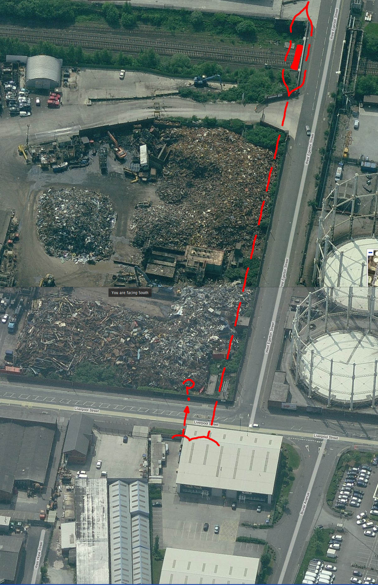
| Above Left: Sketch showing the three main tunnels. North to south they are: West Egerton Street (473yds), Ellesmere Street (291yds), West Park Street (172yds).
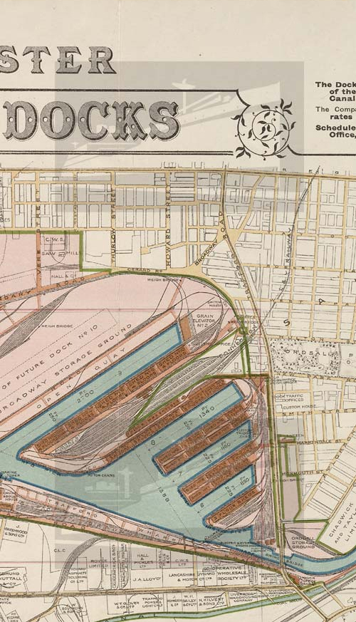
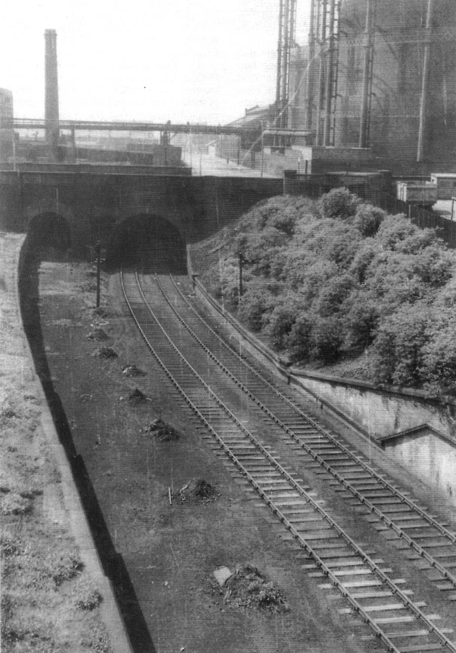
Top Right: 1921 map showing the branch south of Regent Road in relation to the old terrace road layout. Above Right: The three tunnels sketched onto a modern map. The purple lines are the old terraces. There was also a single bore tunnel adjacent to the north portal of West Egerton Street tunnel which ran to a brick works. I don't know how long it was or when it closed - anyone? Below Left: View of the northern portals under Liverpool Street. West Egerton Street is on the right and the brick works tunnel is on the left. Below Right: Aerial view from Multimap showing a warehouse built on top of the infilled northern portals (West Egerton Street and the brick works). The dotted line is the approximate course of the tunnel. It widened under the Liverpool and Manchester main line, each track passing around a central supporting pillar. It then curved underneath West Egerton Street and came out south of Regent Road. There was a short open space then the tunnel entered Ellesmere Street tunnel north portal adjacent to the erstwhile Martha Street (now approximately under the junction of St Joseph’s Drive and Flagship Avenue). The south portal was in the south west corner of St. Joseph’s school playing field below Robert Hall Street which used to run through to Trafford Road. The southern tunnel, West Park Street, went in under West Park Street which also used to run through to Trafford Road (and is now Phoebe Street). The southernmost portal was on the West side of Trafford Road under the BP garage. Click on each item for a bigger version (except the sketch). You can also download all items plus a photoshop copy of the map (above right) which overlays the modern map on an old ordnance survey map. Use the Opacity slider to fade in and out. |
|
 |
 |
| Back to 3rd October 2009, Oldham | |
| ©Copyright 2010 Tunnels UK (Steve Power). No part of this website may be copied or used for any purpose without our permission. Photos may be copied to your hard drive but must not be further used for any purpose without our permission. |